I was asked about Lennox Bridge some years ago during a conservation campaign. When in Sydney for less than 48 hours in December 2019 I was determined to get to see it.
A PDF version is available here.
Lennox Bridge is an integral part of Mitchell’s Pass, the old road into the Blue Mountains (I presume through them as well, but I didn’t get that far). It is the oldest surviving stone bridge in mainland Australia (an older one off the mainland is in Richmond, Tasmania, and was opened eight years earlier in 1825). It has taken four months for this to make BoM because we had to do a clean-up job on the model to remove (more or less) some particularly offensive graffiti (thanks to Tim for that effort).
It is a thing of some beauty. My visit was aided by my friend Doug Jenkins, a local engineer of much my age and background (sometime academic, now consultant). He picked me up from the station at Glenbrook and spent an hour or so with me at the bridge and a little longer over coffee afterwards. Allow me to recommend his blog which is a source of regular delight to me both on the engineering (Excel) and music (Bach) fronts.

Some of the stone used has proved a little less durable than others, but there can be little doubt that some of the damage we see is mechanical.
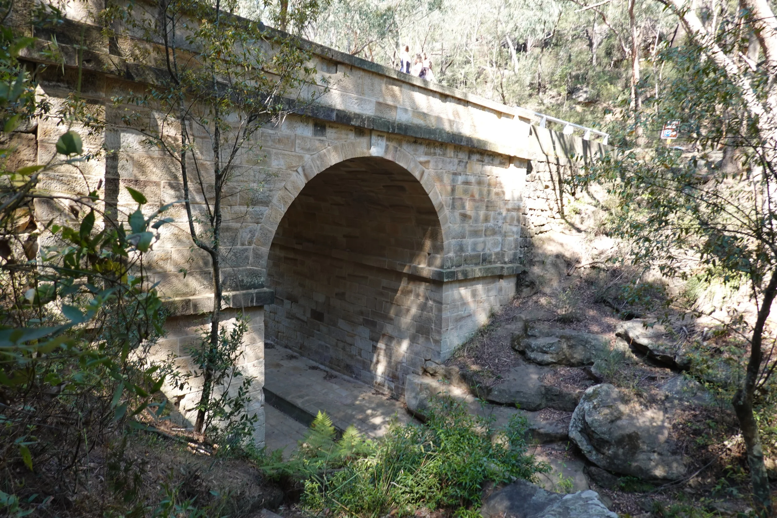
The span is 20 ft, the semi-circular arch springs 20 ft above the paving and the roadway is 30 ft wide. It is a real piece of work to be completed, in what was then a wild place, in a matter of five or six months. The stone was quarried locally, which is convenient, and the patterns in the beds add considerably to the beauty of the bridge.
The site is only a mile from a busy community, but peaceful and almost deserted. This picture from upstream doesn’t show the curve to accommodate the hairpin bend on the road. I suspect, from the change in construction, that the dressed wing walls represent the thickness of the abutments.

I don’t often find myself sharing a bridge inspection with a group of models on a photoshoot!

The ease of finding a foundation is illustrated by the exposed rock here at the downstream end.

We have a 3D model of the masonry but not the road, so only an upward view is available to show the layout.

And here to emphasise the colours.

There is a crack up the upstream end of the right abutment that begins here. The cause is surely, at least partly, lack of tight fit to the bedrock causing the lowest stones to try to tilt out.

The crack then works up through the springing and into the arch, before tapering out to nothing in the arch.


There are other cracks through that abutment, but none of them can be regarded as threatening to a bridge that is close to 100 years old.


The river was dry when I was there (as was everything else, with much of this side of Australia on fire at the time). There is obviously enough rain at times to erode the foundations of that paving. A little work here soon wouldn’t go amiss: there is no convict labour available now of course!
Oh, and before I forget. The double curve of the wing walls is beautifully done. I wonder what masons as good as this had done to warrant transportation as a punishment?

And great to see that Mr Lennox gets the credit, not Mitchell, who was responsible for the whole road.

And lockdown or no, that will have to do for this month except to invite you to explore for yourself with the model at: https://skfb.ly/6RZEx .
In this model the faces can be viewed from both sides and rolling over the outside of the arch allows you to see areas where the mortar is missing.
The photographs were taken with a Sony RX100VI hand-held, many up to 10m from the face.