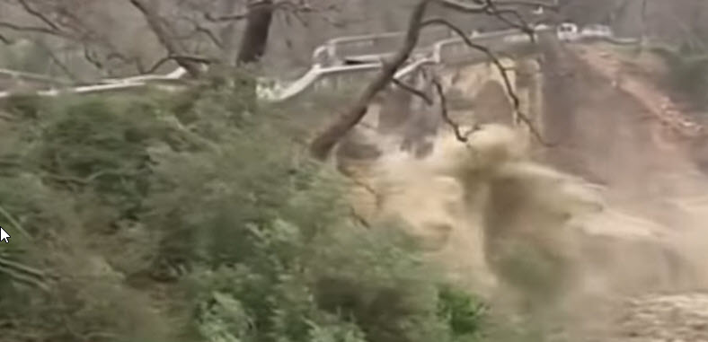
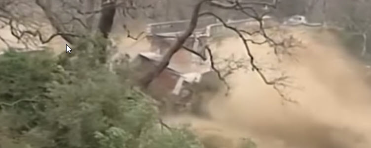
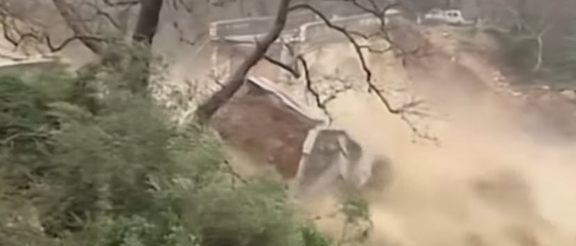
Time for something completely different. This is the fist BoM that I haven’t actually seen myself. Back in March I received an email out of the blue from Marios Angelis saying simply “I thought it may be of interest to you, old bridge collapse in Greece.” The linked video showed the collapse of an arch bridge in flood. There is a shorter video on the BBC web site showing just the actual collapse and without a water mark to obscure what is happening. Later in the spring, Hamish was nearby on holiday and took his camera along to the site at Alikianos. The resulting model and the photographs from which it was made provide ample food for thought.
The damage is absolute, though one span remains standing, little is left of the rest of the bridge. This is the upstream side. The river is generally just a trickle but obviously subject to violent storms and a concrete apron has been provided to resist erosion under the bridge. At some point, the river obviously got right under it. So lesson number 1, protection like this needs a curtain wall at the leading edge or water may pipe and wash out the support.
The video is not high quality and grabbing stills reduces that further, but I think it is worth doing.
The first shows the bridge apparently undamaged, but look carefully. Is that parapet level through?
Put a line along it and obviously not.
The kinks are just perfectly obscured by the tree branches.
As the collapse progresses, first the downstream side of the centre span drops out.
Then the pier begins to topple.
Eventually it tips into the river with the downstream sections breaking up and washing away.
This picture shows the full length of the bridge. The temporary road and its pipe bridge illustrate how small the flow normally is. The big block in the front of the picture is the abutment. The approach embankment is gone completely. The remains of the intermediate pier is in the middle distance.
Looking at the abutment from the other side (essentially the top) we see that it is a block of masonry faced concrete.
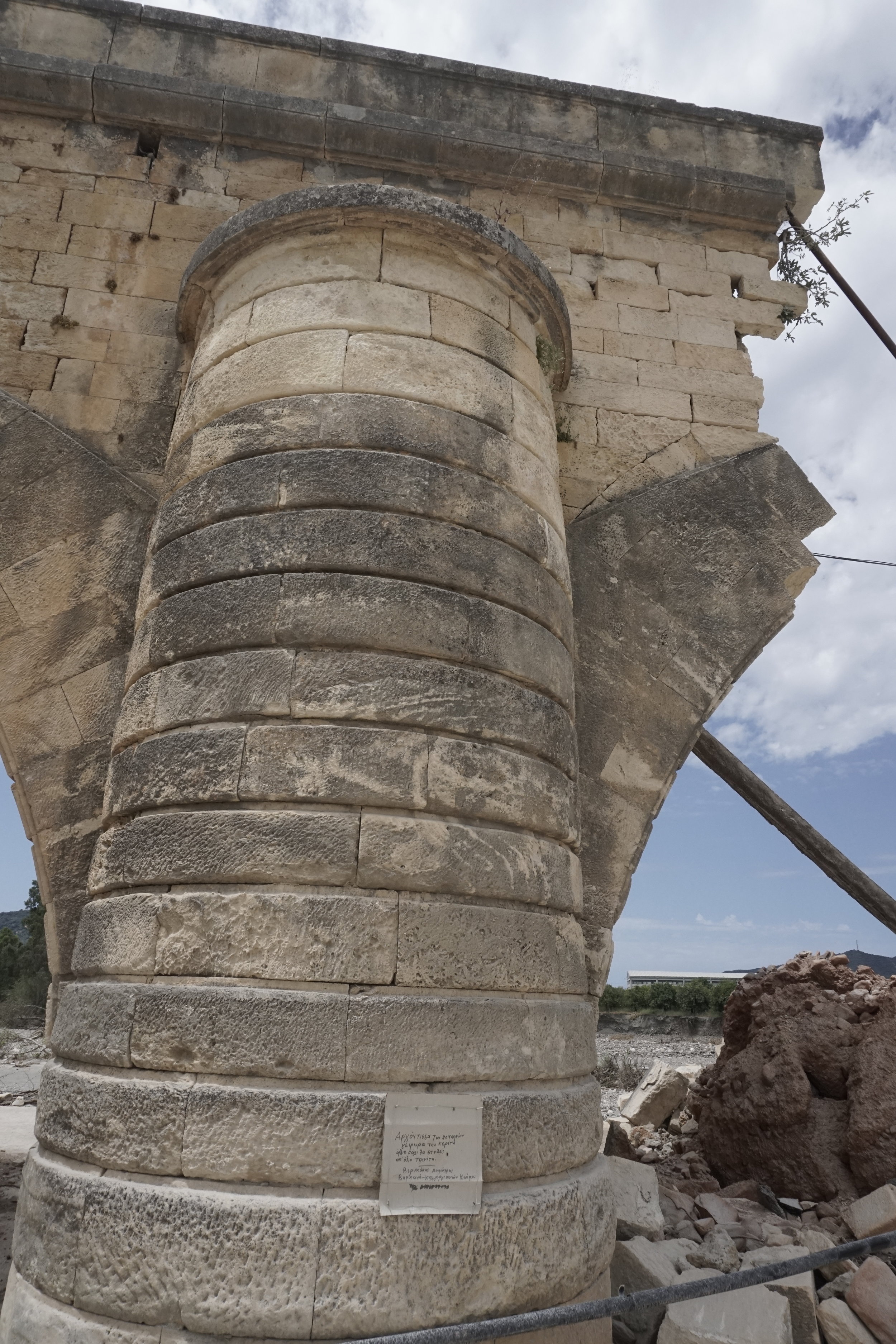
Below is the base of the upstream end of the pier.
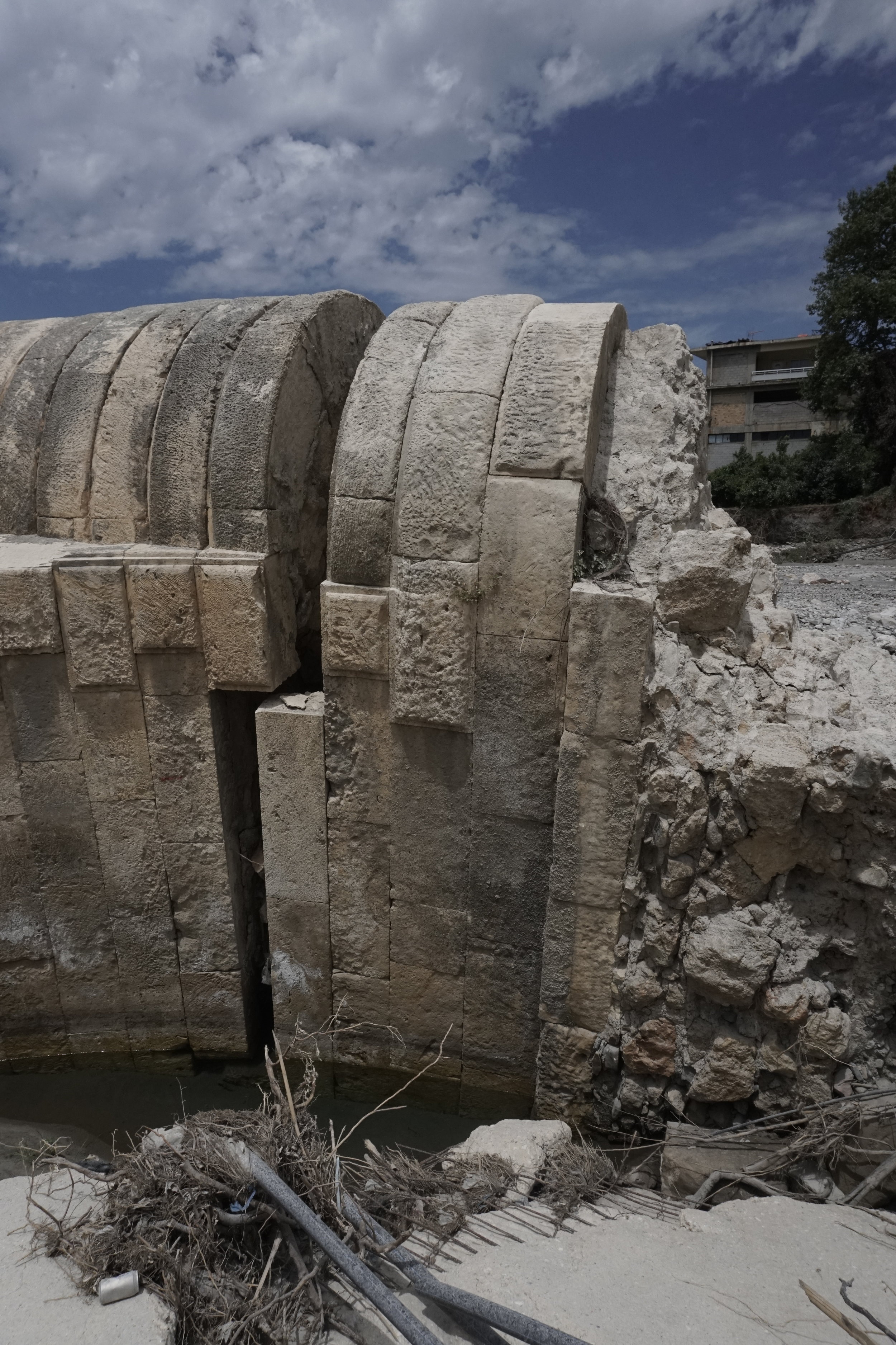
The other pier remains and shows what this should look like.
Above, you can also see that the voussoirs are alternately full depth and in two parts.
Looking at the broken end it becomes clear that the bulk of the width of the arch is in two independent layers.
Zooming in more closely we can see that the inner layer of ring is of much lower quality. Roughly squared stone, lots of mortar but significant voids. In the same way, the core of the spandrel wall is very roughly built and the stone just taken from the river. The fill looks like rocky soil but this is almost certainly very weak rubble concrete with fill walling over it from below. And look, there is a drain at mid width which probably penetrates to the mortar screeded upper face of the backing.
The abutment beyond looks fine from this side (upstream).
Downstream, we get to see the embankment washed away, exposing the construction.
The stone is beautifully dressed down to the surface and then becomes mere rubble masonry. Looking back at the other abutment, the quoins at the back corner are evident but it has broken down to the bottom of the ashlar finish.
And what is going on with those voussoirs.
The section beyond the pier looks very similar.
It’s as though they set off to make a constant thickness but variable radius arch, then changed their minds and dressed the stone back to a much flatter curve. The original appearance is shown beautifully on a picture published by the Greek Observer here. This picture by C Messier has been placed in the public domain for which I thank them.
Without the ability to lift the camera high, and despite the limited time and number of photos, the 3D model produced is of real value in exploring the debris. Click on the play button and give it time to resolve detail then you can pan around with the mouse and left button or slide across with right button.
Perhaps the saddest part of the story is mentioned alongside the picture.
The bridge of Alikianos, over Keritis river. The bridge was built in 1908 and was the place were 118 villagers were excecuted by the Nazis in 1941. Now it is a monument.
Perhaps this BoM can help to perpetuate that memory.


